Whistlepipe Gully – Lesmurdie Falls Walk overview

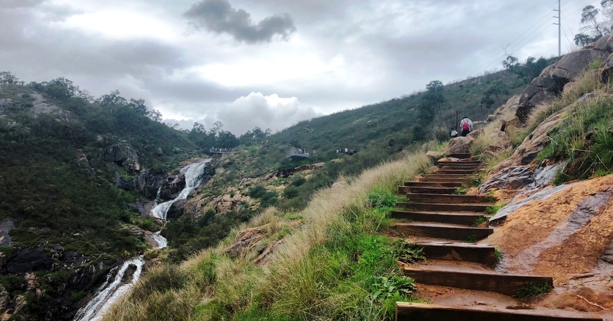
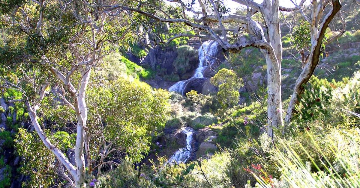
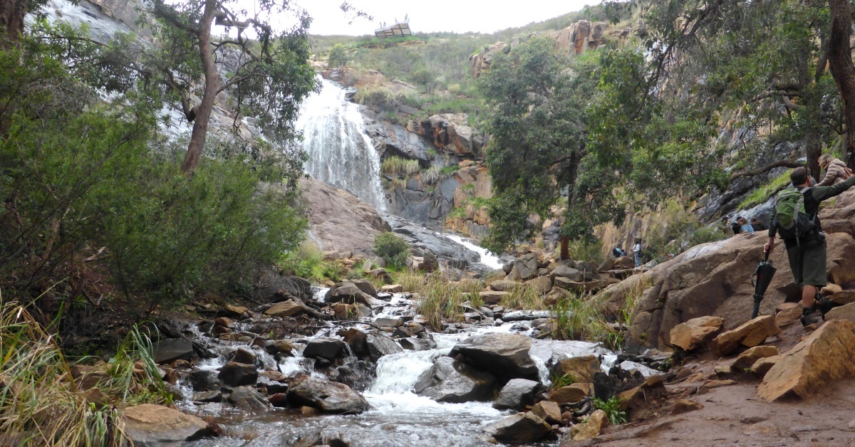
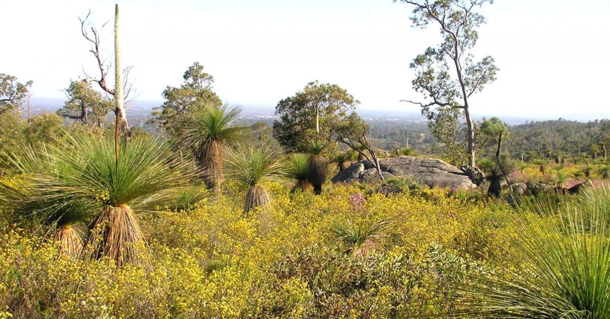
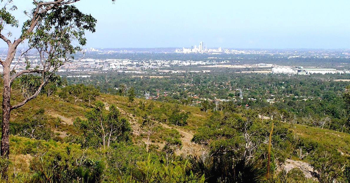
An enjoyable, scenic introduction to the heathlands and forests within Mundy Regional Park along the Darling Scarp at the western edge of the Darling Range close to Perth. The Scarp provides sweeping views to  the coast and Perth city. Spring is always an excellent time to visit because of the prolific heathland wildflowers. Following winter to spring rains the Lesmurdie Falls also cascade impressively down the Scarp over two main drops totalling about 50m.

  • Main features / Highlights

    Walking in this area close to Perth is an enjoyable and scenic introduction to the heathlands and forests along the western edge of the Darling Range.

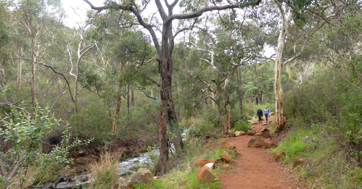
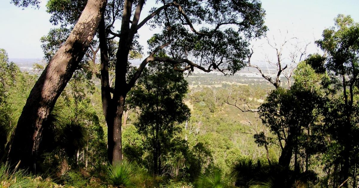
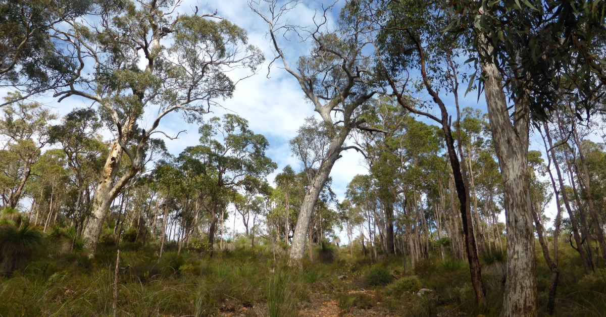
    Suburbia intrudes on the Darling Scarp from both west and east in this area, but a reasonably protected and unbroken strip about 1km wide covers the mainly steep and rugged slopes of the Scarp and extends N-S for about 4km between Welshpool Road in the south and Kalamunda Road in the north. This strip, lies within the 538ha Mundy Regional Park which contains extensive areas of relatively undisturbed low heathland and patches of mixed forest (including marri and wandoo), plus flowing streams, and noteably, in the south the small Lesmurdie Falls National Park (56ha), including Lesmurdie Falls. In winter to spring the Falls usually cascade impressively over two main drops totalling about 50 metres. The short (2km) Lesmurdie Falls Walk Trail, which is incorporated into this route, was selected by DSR and DEC (now DBCA – Parks and Wildlife) in late 2008 as one of about 30 bushwalking trails in WA to be promoted by Trails WA as “Top Trails”.

    Spring is always an excellent time for walking the Scarp because of the prolific heathland wildflowers.  The Scarp also provides wide panoramas of the coast and Perth city. Despite the proximity to suburbia and the city views you will still be able to find some sense of ‘wilderness’  even here.

    There is a fairly extensive network of tracks/trails along this section of the Scarp. There are endless options for varying and combining the existing trails into longer or shorter walks.  The WalkGPS route here  is one combination that achieves not only a day walk of reasonable length but also some variety of terrain and scenery (including Whistlepipe Gully and Lesmurdie Falls) while not ‘overdoing’ the amount of steep uphill walking and also minimising on-road walking (about 10% or 1.3km of the route is on sealed roads). The route also offers the option to easily shorten the walk at various points if the distance and hill work does prove too challenging on the day!

    Walkers are often intrigued by the old house ruins below a large granite outcrop in Whistlepipe Gully. The imaginative Japanese-influenced house was built in the 1960’s and actually straddled the stream course. It used the granite rock faces partly as walls and sourced its own electric power from the stream flow using a ‘Pelton’ wheel. (See link below for more details on the fascinating history behind the ruins.)

    Shorter walk options:  See ‘Other info.’ tab for links to a number of  marked walking trails on the Trails WA website; most are short walks of around 4-6km.

    For other day walks along the Darling Scarp also see WalkGPS Bickley Reservoir – Lions Lookout Walk and Banyowla South Walk on this site.

  • Route notes

    Start at the carpark at the end of Lewis Road. A gate with a “Mundy  Regional Park” sign marks the start of the Whistlepipe Gully Walk trail. Follow the wide trail eastward along the south side of the stream. Just before reaching a small concrete bridge across the stream, turn right (at ‘1’) onto a smaller foot-track which climbs a short way up the hillside and over a granite outcrop before returning to the stream bank. – Beneath the granite outcrop you will see the ruins of the house built in the 1960’s which straddled the stream course and used the granite rock faces partly as walls. (See “Mythic houses…” under Other info.).  Continue along the south bank of the stream until ‘2’, then cross the stream to the north side via the wooden bridge. Follow the wide and pebbly track steeply uphill, ignoring side tracks on the right at ‘3’ and ‘4’.  Meet Ozone Road (at ‘5’).  Follow the sealed road initially westward, around the hillside (near the top of the Scarp) for a total of about 1km, getting excellent sweeping views across the coastal plain to Perth and the coast.  The road curves northward to ‘6’. (Ignore the side road, Prospect Court, on the right.) Veer NE into Panoramic Terrace (at ‘8’) and after less than 100m turn left (at ‘7’) to head NW along a dirt track which meets a junction with another track after 200m (at ‘8’).

    The section of the walk, from waypoints ‘8’ to ’17’, now follows much of the West Terrace Walk Trail, but in reverse direction to the purple markers. – At the track intersection at ‘8’ take the northward track and soon descend quite steeply downhill to a T-junction with another track near the south bank of Crumpet Creek (at ‘9’). Take the right fork and cross the stream over a culvert (at ’10’), then follow the track steeply uphill to meet another T-junction (at ’11’).  Again take the right fork which heads initially downhill then up the valley. Ignore t vehicle tracks entering from the left at ‘12’ and ’13’. Re-cross the creek  at a bridge (at ’14’). Immediately after crossing the stream the vehicle track on the left, initially following the south bank upstream then veering southward through a track junction at ‘15’ and climbing steeply uphill (past houses on the left) finally reaching a T-junction (at ‘16’) near  the edge of the flatter, lateritic plateau surface at the top of the Scarp. Follow the track  approx. SW around the plateau margin through forest to another T-junction (at ’17’). Turn left to follow the track a short distance uphill to meet Prospect Rd (at ’18’). Veer left (eastward) onto the sealed road and within 50m reach an intersection of four sealed roads (at ’19’). Turn right (south) onto Ozone Tce, with the bushland of Mundy Regional Park on your left. Within 100m (at ‘20’) turn left onto a vehicle track to enter the bushland (initially mainly parrot bush and scattered marri trees).  After  ~50m (at ‘21’), where the vehicle track curves to the left (ENE), take the minor sidetrack on the right which connects to another track at ‘22’ within 30m. Turn left to follow this track ENE to a junction with a vehicle track at ‘23’. Turn right to follow this track southward to a junction at ‘24’. Veer right and immediately locate another track entering at ‘25’ (A small orange  boulder sits at the right side of the track entry.)  Take this entry to head initially southward and then SE down the hillside through slightly more dense forest. Pass through a track junction at ‘26’ and at ‘27’ locate and follow a minor track more steeply down the hillside, meeting a wide,  unsealed vehicle track (an extension of Orange Valley Rd) at ‘28’. Turn right onto this track and at ‘29’ re-cross Whistlepipe Gully stream by the wooden bridge.  Then, within 20m, locate and follow a minor foot-track which veers left off the vehicle track to head SW up the hillside toward the top of the Scarp, initially passing through heathland and then into young jarrah forest with an abundant understorey of Winged Wattle (Acacia alata). Meet a vehicle track at ‘31’ and turn right to follow the track approx. SW  (via ’32’ and ‘33′) along the hillside with pleasant valley and Coastal Plain views through forest and across open heathland. Take a left branch of the track (at ’34’).  The track climbs steadily and veers left (ESE) to enter forest (about ‘25’) toward the top of the Scarp (near the end of Ashurst Drive, an alternative access point). Then turn right at ‘36’ near the site of a former wireless station and old house ruins and descend toward Lesmurdie Brook. (Or see Optional short walk extension below to include more walking along the upper Lesmurdie Brook.) After the track veers right, reach a track junction at ’37’. Veer right to follow the track along the valley slope. Take the next track branch on the left (at ’38’) to cross the Brook and then turn right (at ’39’) to follow the south bank of the Brook downstream to Lesmurdie Falls picnic area (at approx. ’40’; toilets, picnic area and carpark nearby). Continue on along the Falls track (via ‘41’) to reach the viewing platform (at ‘42’) which straddles the Brook at the top of the Falls. There are good views SW down the Lesmurdie Brook valley to the Coastal Plain.  Follow the track SW along the steep south face of the valley (via ‘43’) and at a track Y-junction at ‘44’ veer right to follow the track downhill to meet a trail (at ’45’) along the south bank of Lesmurdie Brook.  If time and energy allows, as an addition to the walk, turn right (east) to follow this trail to ‘46’ near the foot of Lesmurdie Falls (especially worthwhile in winter-spring when the Falls are in full flow).  Then follow the trail west to reach a carpark at ‘47’ at the end of Palm Terrace (a sealed road).  Follow Palm Tce for 300m, then turn right (at ’48’) through the gate to follow the vehicle track (Waterfall Rd) initially NE along an old fenceline, then veering east and uphill before crossing Yule Brook gully (at ’49’).  The track then climbs quite steeply northward around the hillside to meet  T-junction (at ’50’). Take the left fork and follow it downhill. At ‘51’, where the vehicle track veers westward, locate and follow an old foot-track on the right which heads northward to meet Lewis Road at ‘52’ after about 300m. (Note: There is a Shire of Kalamunda track sign on a marri tree just past the track entry but this old track is not maintained and little used, so may be a little challenging to follow in places. Alternatively you can stay on the vehicle track after ‘51’ to meet Lewis Rd within 200m.) From ‘52’ just follow Lewis Rd for ~100m to return to the Start point (‘53’) at the Whistlepipe Gully carpark.

    Optional extension after waypoint ’36’ – Continue gently uphill, soon passing a communication tower. Turn right at ’37-ALT’ to follow a foot-track which soon joins a vehicle track.  Veer right to follow the track down the hillside. Meet a well formed foot-track at ’38ALT’ and turn sharp right to follow the track SW-ward along the NW bank of Lesmurdie Brook for about 0.3km to rejoin the described route above at ’39’. This option adds only 5oom to the total walk distance and provides an opportunity to see the incredible progress made since 2012 by volunteers of the Friends of Upper Lesmurdie Falls and Rotaract Club of Kalamunda on rehabilitating this previously degraded section of Lesmurdie Brook above the Falls. Before the rehab. project, the Brook and its banks were badly eroded in places and infested with weeds. Although there is still a big task ahead, the public is already able to enjoy new quality trails complete with bridges and stone crossings across the Brook, nicely tailored to fit into the environment. (See also ‘Other info.’ tab for details of the rehab. project.)

  • Access / Directions

    Via Orrong Road or Shepperton Rd, then Welshpool Rd, then 1.5 kms past Tonkin Hwy intersection turn left into Lewis Rd. Follow Lewis Rd to end and parking area at start of Whistlepipe Gully Trail.

    Other access options: This section of the Darling Scarp between Welshpool Rd in the south and Kalamunda Rd in the north is very accessible from either the foot of the Scarp to the west (Wattle Grove / Forrestfield) or from the top of the Scarp (via Lesmurdie or Kalamunda) in the east.  A few of the options for alternative access to the trails in this area include:

    – in north, via the carpark past the end of West Terrace Road;

    – in south, via carpark and picnic area at end of Palm Terrace (off Lewis Rd),  which gives access to the lower Lesmurdie Falls trails;

    – via Lesmurdie and Falls Road:  carpark and picnic area (plus toilets) at Lesmurdie Falls off Falls Rd;

    – various other entry points from the  top of the Scarp:  including Connor Road and Ozone Terrace.

    Google Map

  • Nearest campsite/s

    N/A.

  • Escape route/s

    Via the various tracks either west down the Scarp or east up the Scarp.

  • Other Info.

    “Darling Scarp Field Excursion…”, in Nov. 2006 Newsletter (pp.4-10) of Friends of the E de C. Clarke Earth Science Museum. -This provides an excellent summary of the geological origin of the Scarp.

    Friends of Upper Lesmurdie Falls website – Information on a long-term project to rehabilitate a previously degraded section of Lesmurdie Brook above the Falls.

    “Mythic Houses: Some Western Australian examples”, Duncan Richards, 2006. – This includes, on pages 5-6, the fascinating details and history of the Whistlepipe Gully house ruins (also see cover pictures of the original house). No longer accessible online.  But see “Whistlepipe Gully and the Wallace Greenham House”, which now also includes some excellent historical photos.

    Mundy Regional Park, DBCA – Parks and Wildlife’s site includes a brief description of the Park.

    Walks on Trails WA site:

    Be aware that parts of the ‘established’ trails in the area are not well marked, so it is wise to have  a good walk description with you.

    Other map availability

    South West WA 25K Scale Topo Maps”, Greg Harewood & Landgate,  2015.  – Digital raster; ECW format on 16GB USB. See tiles #320-2134-III-SW and #314-2133-IV-NW for relevant map coverage.

Back to top