Christmas Tree Well Walk overview

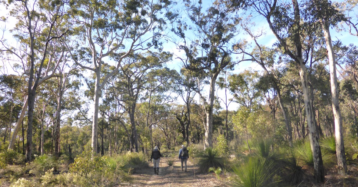
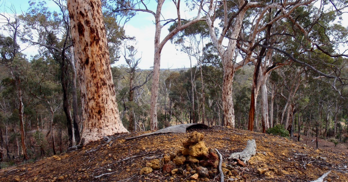
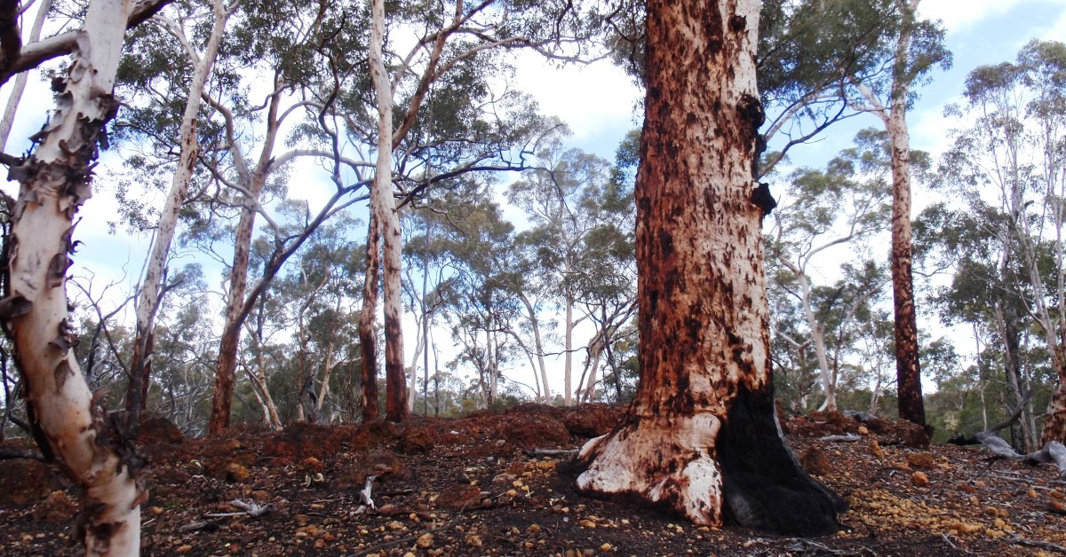
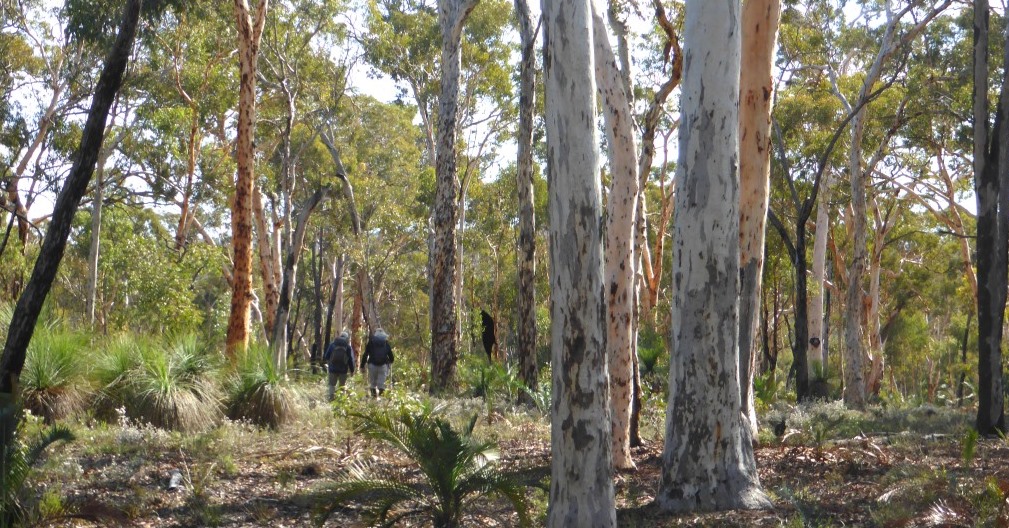
A relatively short and easy ramble through picturesque open wandoo woodlands with some shorter sections of jarrah forest. Much of the area lies within one of the very scarce areas of remnant old growth forest in the proposed Russell Conservation Park. “The character and form of the widely spaced virgin wandoo creates a most unique bush atmosphere which is a delight to any bushwalker”. Christmas Tree Well near the picnic area at the start point was one of the old watering holes used in the days of stage coach travel. Future bauxite mining is a potential future threat despite the proposed Conservation Park status. (This walk route is a revised 2023 version.)

  • Main features / Highlights

    This walk is a relatively short and  easy ramble mostly through picturesque, open wandoo woodlands, with some shorter sections of jarrah forest. Seventy percent of the route (the area east of Yarra Road) lies within one of the very scarce areas of remnant old growth forest. At present that area is still part of the State Forest and is not included in the nearby Wandoo National Park. It is included within the proposed 3360ha ‘Russell Conservation Park’ as flagged under the current draft Forest Management Plan 2013-2023, but conservation park status offers no protection from possible future bauxite mining which remains a threat. (See Bauxite mining on WalkGPS.)

    Christmas Tree Well near the picnic area at the Start point was one of the old watering holes used in the days of stage coach travel.

    The route is over reasonably gentle terrain, with only a few modest slopes around the low, laterite-capped, forested  hills.  Expect a few short sections of low scratchy heath.

    Meney & Brown, 1985 (see Other Info.) have previously noted of this walk area that “the character and form of the widely spaced virgin wandoo creates a most unique bush atmosphere which is a delight to any bushwalker”. There are only limited forest views from the low hillsides, but the beauty of the woodlands combined with the prolific wildflowers in late winter to spring more than compensates for the limited variety in  the terrain. M.&B. also noted that this area lies within “the largest remaining woodland of uncut wandoo in the south west, and is therefore of immense conservation value.”

    Longer walk option: This walk can be combined with the eastern portion of the Running Brook Walk for more variety in terrain and some good views.
    Option for more valley walking:  See the Route notes for details.

  • Route notes

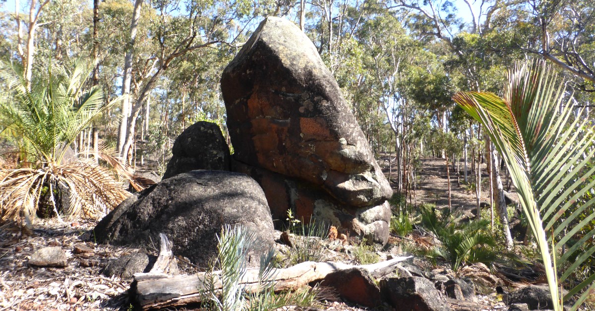
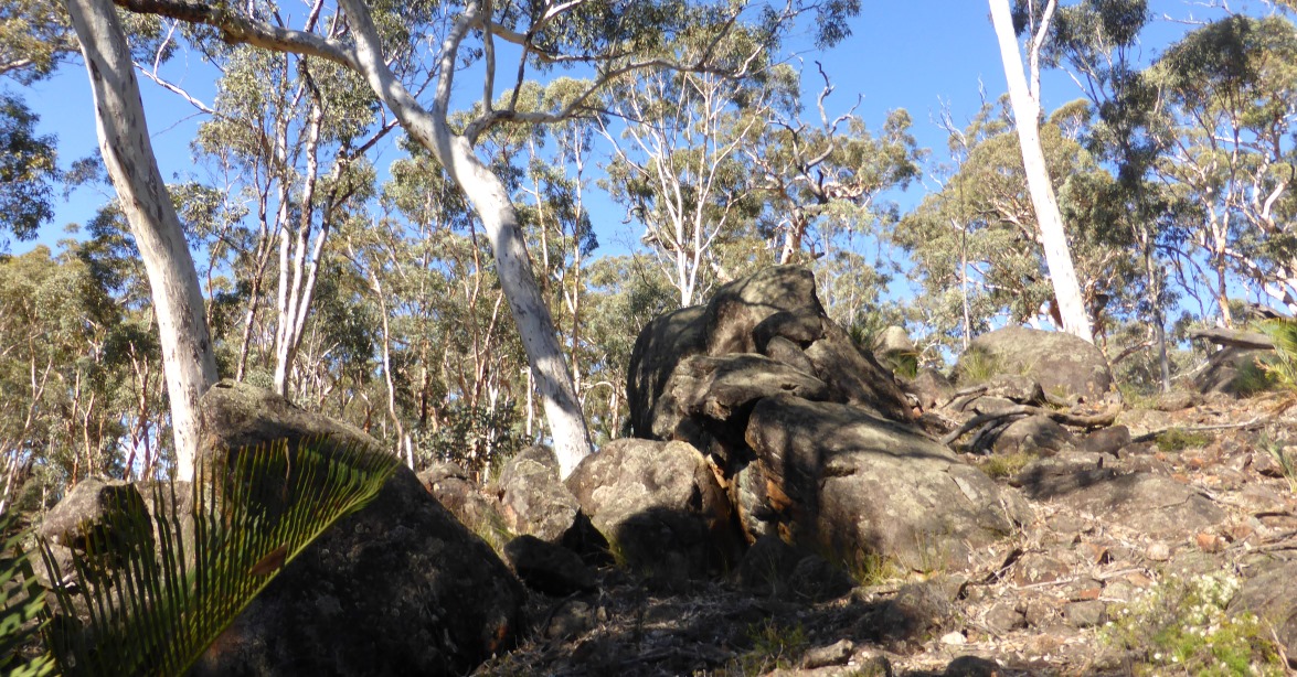
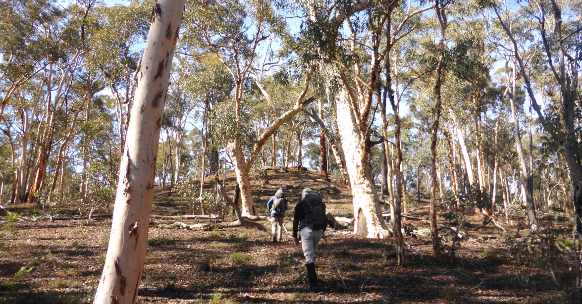
    Head initially north from the start point (at waypoint ‘START’) mostly following a sandy track and passing the waterhole and nearby grated, historic well on the right.  After about 150m, at ‘1’, veer NE off-track to enter light forest and low heath, soon climbing gently uphill to reach a small tor of diorite rock at ‘1-1’ after 500m.  Continue NE across gentle terrain and through mainly jarrah forest. Meet an old forestry vehicle track at ‘2’. Turn right (E-ward) to follow the track down the gentle hillside to cross a broad, open valley floor for about 1km to reach Yarra Road (at ‘3’).  Cross the road and continue eastward through open forest, initially mainly jarrah, transitioning to open wandoo woodland.  Veer slightly right at ‘4’ and soon descend gently through open wandoo woodland, and after about 1km from Yarra Rd reach a stream course at ‘5’. Cross the valley floor and continue roughly ESE-ward, climbing gently upslope. Reach a laterite-capped ridge at ‘6’ flanking a gully to the left (NE). Continue ESE-ward around the head of the gully through open woodland and take the time to explore a cluster of boulders in this area (dark, diorite rock not the more common granite) sculpted by nature into a wide variety of fanciful shapes. At ‘7’, turn sharp left to head roughly NNW down the gully, following the eastward side, with a rocky, laterite breakaway prominent upslope to the right. Veer right at ‘8’ to head NNE, very gently downslope toward the valley floor. At about ‘8-1’ veer northward and pick an easy route through fringing shrubland to cross a small stream (usually flowing by mid-late winter). Then head NNW down the valley, with the stream course to the left, for about 500m (via ‘9-1’, and crossing a vehicle track at ‘9-2′).  At ’10’ veer NNE to head uphill quite steeply to reach (after about 300m) more open wandoo woodlands at ‘10-1’. Veer right (east) to reach a spur ridge at ’11’ and climb to the top of the nearby small, rounded hill at ’12’.  Descend E-ward from the hill top, cross a small saddle and reach another small but slightly higher, distinctly dome-shaped hill at ‘13’, which has a local capping of laterite rock and is almost unvegetated except for a few tall powderbark wandoo trees (M.& B. 1985 aptly noted that this hill resembles a “giant anthill”). Descend the ‘anthill’ S-ward and cross a vehicle track at ’14’. Head SSE downslope and recross the vehicle track at ’14-1′. Continuing SSE, cross a stream course in a side gully and climb gently through mostly open, mixed jarrah-wandoo woodland. The slope eases after ’14-2′.  Reach the lip of a breakaway ledge at ’15’. Veer right (SW) to descend through the boulders of laterite (via ’16’) and continue descending SSE (via ’16-1) through mostly open wandoo woodland to reach the valley floor. After ’17’, head up the valley, with  the stream course mostly less than 30-50m to the right. Veer left (SE) at ’18’ and follow a small side gully upslope.  Turn right at ’19’ to head southward along slope through open woodland via ’19-1′.  Cross a minor spur ridge at ’20’, then descend gently to reach a small low outcrop fringed by sheoaks at ’21’. Veer right (SSW) to descend the outcrop. Cross the nearby small stream at ’22’, then veer right (NW) through open woodland to cross at ’23’ (after 500m) another stream where it runs across granite bedrock. Veer right to head initially northward uphill for almost 500m. Then turn left (westward) to climb directly upslope (WNW), passing through jarrah forest and then into open wandoo woodland to reach at ’25’, after 600m, the broad summit area of the central hill in the area. (Note: The cluster of boulders visited earlier in the walk between ‘6’ and ‘7’ is only 400m NNE of this location.) Continue WNW to descend gently, reaching after 900m a stream course at ’26’, along the floor of the valley. (Note: This is the same valley crossed earlier in the walk at ‘5’.)  Then head westward. After about 250m (at ’26-1′), briefly  follow an old drainage channel, and continue westward to soon re-cross Yarra Road (at ’27’). Continue westward through the forest via ’27-1′. Veer slightly left (WSW) at ’28’, following traces of an old overgrown forestry vehicle track via ’29’.  At ’30’ veer left (SW) to cross a clearing and cross a nearby stream course at ’30-1′. At ’31’ veer right (W) to return to the Start point in less than 400m.

    Option for a shortened walk:  The walk can easily be shortened if preferred after reaching ’18’ by crossing the stream course and heading upslope to rejoin the described route at ’24’, so bypassing ’19’ to ’23’ and shortening the walk by about 1.5km to a total distance of ~11.5km.

  • Access / Directions

    64km SE of Perth, along Brookton Hwy to Christmas Tree Well picnic area entry road on left (about 700m after Dale Pine Plantation and before Yarra Road). Follow the entry road to Christmas Tree Well picnic area about 500m off Brookton Highway (signposted on Brookton Highway). Park at the picnic area carpark.

    Google Map

  • Nearest campsite/s

    N/A.

  • Escape route/s

    To Brookton Highway and/or Dale West Road (dirt road) in south, and/or via Yarra Road (dirt road) which runs north-south.

  • Other Info.

    Bauxite mining – WalkGPS page.

    “Forests on Foot (40 walks in W.A.)”,  Meney & Brown, 1985, pp.93-95 (Wescolour Press, Fremantle).  – Includes a 9km walk which follows a partly similar route to this walk, plus good descriptions of the vegetation. Can be viewed at State Library of WA (book Call Ref. # 919.412 MEN).

    “Forest Management Plan 2014-2023”,  Conservation Commission of W.A. – Appendix 1, p.137 of the Plan identifies the area of old growth forest and proposed Russell Conservation Park (Plan ID#33).

    “Future impact of bauxite mining” under ‘Alerts / Issues’ on this page.

    Other map availability

    South West WA 25K Scale Topo Maps”, Greg Harewood & Landgate,  2015.  – Digital raster; ECW format on 16GB USB. See tile #311-2133-I-SE for relevant map coverage.

Back to top