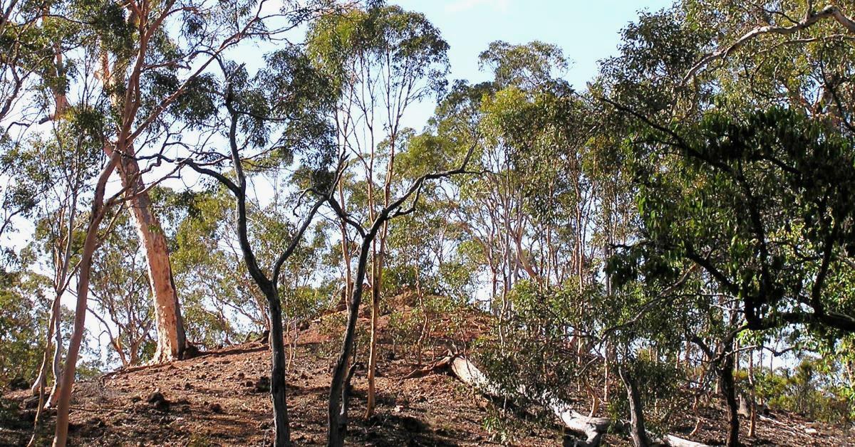
Julimar Walk overview

This walk is within the Julimar Conservation Park, a large ‘island’ of remnant forest NE of Avon Valley National Park and east of Bindoon township. The Park is now an important reserve for native fauna conservation, but is also the  target for a likely future mining proposal after a rare metals ore discovery just to the south in early 2020. The walk route crosses Julimar Brook twice and a few other side gullies, and also skirts the slopes  bordering laterite-capped uplands. The extensive wandoo woodlands were severely impacted by a wildfire across the walk area in early 2007; This resulted in a dense and scratchy new understorey across most of the area which now makes a walk here hard-going and much less pleasant. It may be many years before the walking experience here is once again as enjoyable as it was prior to the fire. Meanwhile, walkers keen to experience the unique beauty of wandoo woodlands will prefer alternative WalkGPS walks in the nearby Toodyay region e.g. Flat Rock Gully Walk, Flat Rock Gully North Walk), or in Wandoo National Park and elsewhere.

  • Main features / Highlights

    This walk is within the Julimar Conservation Park, a large ‘island’ of remnant forest surrounded by farmland, located about 10km NE of Avon Valley National Park and east of Bindoon township. Almost half the park was farmed early last century, but the farms were mainly abandoned in the Depression of the 1930s and later became State forest. The area was then logged for timber until about 1970. The Park is now an important reserve for native fauna conservation. Animals re-introduced to Julimar by CALM (now DBCA) under the Western Shield programme since 1992 include the chuditch (western quoll), quenda (southern brown bandicoot), woylies (bettongs), and tammar wallaby.

    Despite the Park’s history, there are still extensive well-established, picturesque wandoo woodlands (often with balgas as an understorey) in the valleys and on the slopes around Julimar Brook, and mixed jarrah-wandoo forest (and dryandra) on the surrounding laterite plateaus. Sadly however, despite the Park’s important role today in native fauna conservation, it is now also the  target for a likely future mining proposal after a rare metals ore discovery just to the south in early 2020. The miner’s ~160 sq km exploration lease covers more than 40% of the park area, and extends across Julimar Brook and most of this walk route.

    The walk route crosses Julimar Brook (twice) and a few other side gullies, and also skirts the upper slopes around the edges of the bordering laterite plateaus, mainly avoiding the highest ground where, prior to the Jan. 2007 fire, there were frequent thickets of prickly dryandra. The slopes along the route are generally not steep (except locally at a few gully crossings) but they are often pebbly (beware sprained ankles!).  There are  some views of surrounding forest from the slopes above Julimar Brook, including from ‘The Crag’ (informal name). The small laterite-capped butte (here called the ‘Julimar Anthill’; informal name), almost hidden by the surrounding forest (until the fires of early 2007), appears as a pleasantly surprising visual anomaly as you approach.

    The forest is mainly very open and allows for easy walking.  There are some very short sections of scratchy heath but animal tracks usually provide easy paths through. But also see note below on the impact of the 2007 wildfire upon the walk route.

    Option to reduce off-track walking to 50%: The ‘Route notes’ include an option to bypass the off-track walking over the second half of the walk by following vehicle tracks back to the start point.

    Impact of 2007 Wildfire: A wildfire in late January 2007 severely impacted on this area. It may be years before the walking experience here is once again as enjoyable as it was for most walkers pre-2007. See ‘Alerts / Issues’ for more info.

    Possible future impact of mining?: Julimar Conservation Park has become the target for a likely future mining proposal after a nickel ore discovery just to the south in early 2020. See HikeWest News item.

  • Route notes

    Head north along Heine Road from the start point (at waypoint ‘START’), initially crossing a stream gully and then climbing to a Parrot Bush-covered laterite-capped hill top. After about 1.2km the road starts to descend through open woodland. Veer NE off-track at ‘2’ to cross a gully and  soon cross a larger incised stream course (at ‘2-1’). Continue NE gently uphill and along slope, initially through low shrubland and then through more open forest. Veer NNE at a gully at ‘3’ and climbing through more shrubland (following animal tracks where possible) to reach a small granite outcrop (at ‘3-1’) with a view south. Head northward uphill into open wandoo woodland and then into mixed wandoo-jarrah woodland on the edge of the laterite-capped plateau (at ‘3-2’). Continue to follow the edge of the plateau  (via ‘3-3’) and then descend northward to ‘4’ and then NE to soon reach a small laterite outcrop among the wandoo trees (at ‘4-1’). This is a pleasant spot for an early rest stop. Continue approx. NE to cross the nearby narrow gully (at ‘5’),  then continue NE, soon descending to cross a stream course at ‘6’. Then veer eastward around the hillside to cross another stream course at ‘7’. At ‘7-1’ veer NNE to  climb a ridge (via ‘7-2’). There are limited views from here SE across Julimar valley toward the route followed later in the walk. Bypass the crest of the ridge to reach a small saddle at ‘8’.  Then veer east for less than 100m to reach a small but distinctive laterite-capped hill-top butte (the “Julimar Anthill”). Head ENE downhill to cross a side gully (at ‘9-1′) and veer right (eastward) at ‘10’ to cross the incised stream course of Julimar Brook (at ’10-1′) which is flanked by a narrow but fairly dense belt of shrubs. Veer ENE to reach a very small granite outcrop at ‘11’, then veer right (ESE) to cross a vehicle track (at ’12’). Veer left (ENE) and reach the crest of a small ridge at ‘13’ Veer ESE to climb to a local laterite-capped plateau. Cross this through fairly open parrot bush and jarrah to ’14’, then veer south to cross a gully at ’14-1’ and climb to a small ridge in parrot bush at ‘15’. Then veer ESE to descend to ’15-1’ and follow the pebbly slope SE-ward around the edge of the plateau, through mainly open woodland, also passing some patches of a prickly Hakea sp. (probably undulata) around stream gullies. (Keep fairly high up the slope to avoid having to cross the gullies downslope where they become more deeply incised and more difficult to cross.) Veer southward at ’16’, near the head of a gully, to continue along the slope. (This is approximately the halfway point on the walk.) Cross a road at ’16-1′ and continue SSW to ’17’. Then turn sharp left to head SE along slope, skirting around the edge of the parrot bush shrubland which cover the higher ground. At ’18’ veer eastward to cross a side gully at ‘18-1’. Veer ESE at ’19’, then southward at ‘19-1’ to cross a larger gully and follow the east edge of another side gully for about 100m to ‘20’. Then turn right (westward) to reach a small rock ledge which crosses the side gully. This ledge would result in a small waterfall after good rainfall. Cross the ledge and head west along the north-sloping hillside. (Or see Option below if you would prefer all on-track walking from this point on.)  At ‘21’ veer SW around the hillside to cross another gully. Continue along slope via ‘21-1’ to cross a deeper gully at ‘22’. Veer WNW  and cross a vehicle track (at ‘22-1’) and cross a gully at ‘22-2’. (Alternatively, at ’22-1’ you can opt to turn left to follow the vehicle track to ‘alt-3’ and continue from there as per the Option below.) Continue WNW-westward around the hillside via ‘23’. After crossing another gully veer right (NW) at ‘24’ and reach a small laterite outcrop (at ‘25’) above a west-sloping escarpment.  This is a good spot for a rest and has a view NW through the trees back across the Julimar Brook valley and across part of the route already walked. Then turn sharp left to follow the escarpment slope SW-ward. Continue along the partly steeper  slope  via ‘26’, ‘26-1’,  and ‘26-2’ below the edge of a laterite-capped plateau, gaining more views across the valley. Cross a broad, low ridge via ‘26-3’, then veer SW again and gently downslope for less than 100m to reach a small rocky promontory, “The Crag” (WalkGPS informal name; at ‘27’). This offers excellent sweeping views across the Julimar Brook  valley.  Then turn sharp left (SE) along slope and cross gullies at ’27-1’ and ‘28’. Then veer left (SW) and soon begin a mostly gentle descent via ‘28-1’ (initially through some heath and low shrubland) to re-cross Julimar Brook at ‘29’. Veer SSW to climb to a gentle ridge (at ’30’) and then veer right (WSW) to descend to a stream course at ‘30-1’ (about 700m downstream from the crossing of the same stream at ‘2-1’ early in the walk).  (Alternatively, at ‘29’ you can opt to follow Julimar Brook southward  downstream to meet the W-E vehicle track and follow it west to ‘alt-4’  and continue from there as per the Option below.) Veer left (SW) after crossing the stream and reach a narrow ridge at ‘31’. Head up the ridge to ‘31-1’ then  continue SSW to descend gently across the hillside. Cross a W-E  vehicle track at ’31-2’ and soon after cross a stream course. Continue SSW to rejoin Heine Road and to return to the nearby start point.

    Option to halve the amount of off-track walking:  At waypoint ‘20’, soon after the half way point in the walk, if you would prefer all on-track walking from that point on, you can head east from ‘20’ for 400m to reach a vehicle track at ‘alt-1’, then turn right to follow the track southward to ‘alt-2’, then west via ‘alt-3’. Turn left (south) at the track corner at ‘alt-4’, continue southward via ‘alt-5’ and turn right at ‘alt-6’ to follow another track westward to rejoin Heine Road about 130m north of the start point. This option increases the walk distance by 1.4km to give a total distance of ~16km, but reduces the amount of off-track walking to just under 50%. Alternatively the amount of off-track walking can also be reduced by lesser amounts by taking the alterantives described in the route notes above at ‘20’ or ‘29’.

  • Access / Directions

    84km NE of Perth (road distance) via Great Eastern Hwy and bypass, then Roe Hwy, then along Great Northern Highway to about 6.5km past Bullsbrook, then turn right into Wandena Rd, then right again to follow Muchea East Rd. Then continue on Chittering Rd and turn right to follow Julimar Rd (good sealed road) for about 12.5km. Pass Plunkett Rd on right and after about 1.2km reach minor Heine Rd dirt road turn-off on left.  Turn into Heine Rd, then immediately left again to park at the start point in a cleared area close to the corner with Julimar Rd.

    Google Map

  • Nearest campsite/s

    N/A.

  • Escape route/s

    To Heine Road (dirt road) in west (then south to Julimar Rd), or east to one of the N-S vehicle tracks (e.g. to waypoint ‘alt-1’), then south to W-E fenceline, then west to cross Julimar Brook, the  south along farmland perimeter road to Julimar Rd), or in central area, follow Julimar Brook valley south to the farmland perimeter road.

  • Other Info.

    “Forests on Foot (40 walks in W.A.)”,  Meney & Brown, 1985, pp.107-109 (Wescolour Press, Fremantle). – Describes a 16km circuit which follows Julimar Brook north to Cooks Rd and then about 10km of vehicle tracks.  Includes good descriptions of the vegetation. Can be viewed at State Library of WA (book Call Ref. # 919.412 MEN).

    Julimar Conservation Park: a future new nickel province or national park?, HikeWest website news article, 29 July 2023 update.

    “Julimar: turning full circle” article in Landscope magazine (CALM), Winter 2006.

    “Western Shield”, DBCA – Info. on DBCA’s lead animal conservation program which includes the Julimar area.

    Other map availability

    South West WA 25K Scale Topo Maps”, Greg Harewood & Landgate, 2015.  – Digital raster; ECW format on 16GB USB. See tiles #335-2135-III-SE and #340-2135-II-SW for relevant map coverage.

Back to top