Mount Gorrie Walk overview

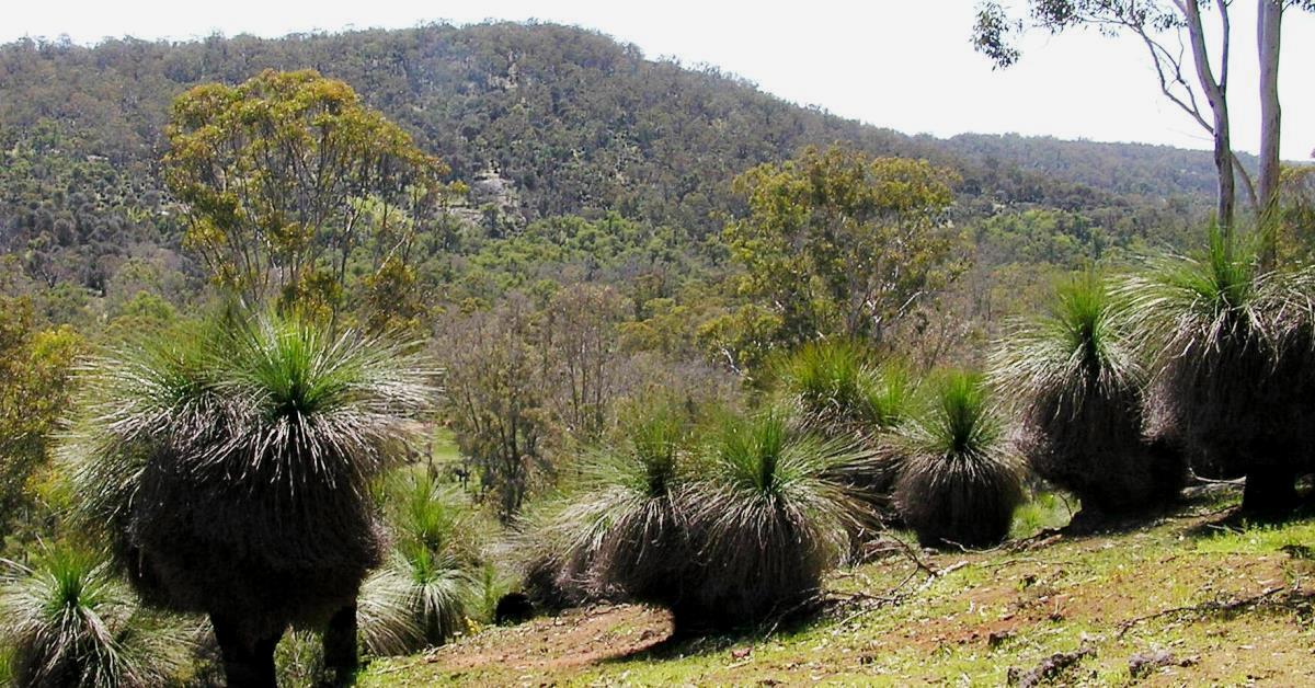
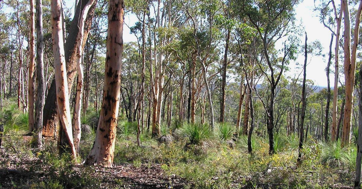
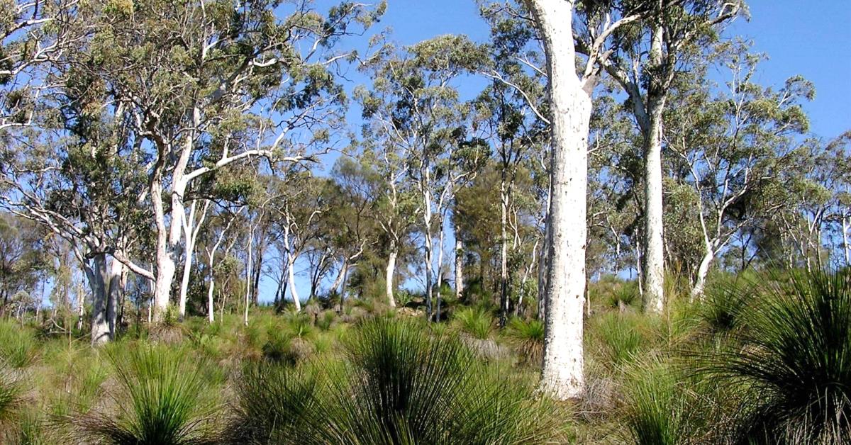
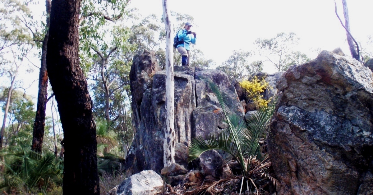
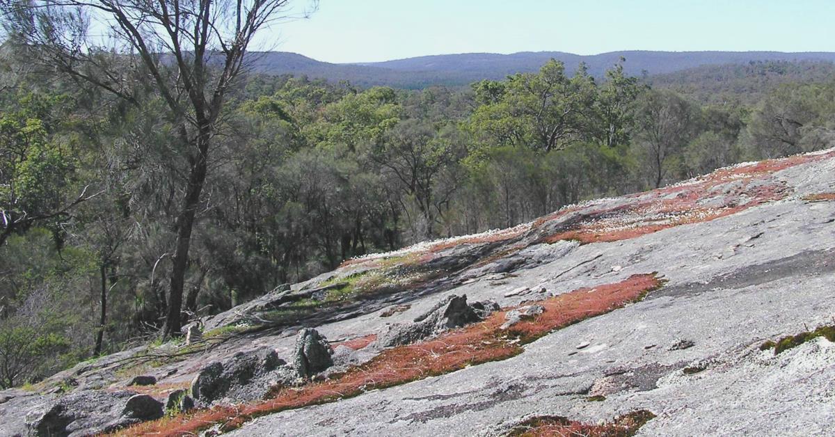
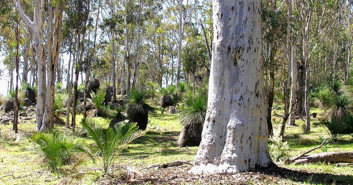
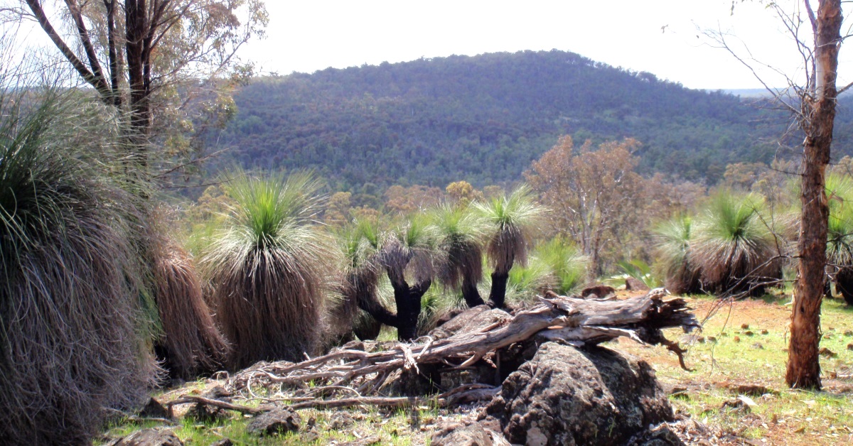
This area offers mainly easy walking through pleasant open wandoo woodlands and some ‘kangaroo pasture-lands’ north and south of the Helena River, about 16km upstream from Mundaring Weir. There are a few short climbs to low ridges and hillsides along the route which include some good vantage points, especially from the rocky outcrops, with good views across the upper Helena River valley and Mount Yetar, and to Mount Gorrie itself. In winter-spring the two crossings of the Helena River may require getting feet/boots wet.

  • Main features / Highlights

    This walk is almost entirely off-track, but involves mainly easy walking through pleasant open wandoo woodlands and some ‘kangaroo pasture-lands’ north and south of the Helena River, about 16km upstream from Mundaring Weir. The Mt Gorrie summit is not the highest point reached on the walk and is itself unremarkable, but there are a few other short climbs to good vantage points along the route, including some rocky outcrops, with good views across the upper Helena River valley and to Mount Yetar and back to Mount Gorrie itself. Two crossings of the Helena River which in winter-spring may require getting feet/boots wet.

  • Route notes

    From the start point (at waypoint ‘START’) follow the vehicle track west across the ford across Wariin Brook and in less than 150m at ‘1’ veer WNW off-track across a gentle ridge, through open wandoo woodland. Cross a stream course at  ‘2’. Climb steeply for 200m to a low rocky ridge at ‘2-1’ then walk along slope toward ‘2-2’. Cross the head of a small gully draining southward before climbing again to reach another rocky ridge at ‘3’ . Climb the initially quite steep ridge toward the NNW via ‘3-1’ through partly scrubby bush and sheoak forest (picking an easy way around low, thick heath over much of the crestal area) to reach a rock outcrop at ‘3-2’ with views SW across a small valley toward a larger rock outcrop (at ‘5-4’, which you will later reach). Continue NNW to cross Cavern Road at ‘4.’  Veer NW through open wandoo woodland onto the flat crest of the ridge (and the highest point on the walk at elevation 324m). Then turn approx SW at ‘5’ to head down the hillside. Recross Cavern Road (at ‘5-1’) and reach a nearby small rock outcrop at ‘5-2’.  Continue SW downhill to cross another dirt road at ‘5-3’ in a sandy  valley. Then climb approx SW up a short steep slope to reach the larger east-sloping granite outcrop at ‘5-4’ with good views to Mount Yetar (8km ESE). Walk SSW along the outcrop and partly through sheoak forest to reach ‘6’  which is near the top of a gentle spur ridge.  Then head southward downhill. Pass a rocky outcrop near ‘6-1’then veer SE to cross a W-E stream gully at waypt ‘7’. Veer ESE along  a very gently sloping hillside through open wandoo woodland to reach waypt ‘8’.  Then descend gently (partly through an understorey of abundant balgas) to soon cross at ‘9’ a vehicle track along an old N-S fenceline which here passes through a saddle area between hills to the west and east. Continue SE up and along a hillside to a rock outcrop at ‘10’ at the head of a small gully. This is on the western flank of a ridge which extends southward ~2km to Mount Gorrie summit at its south end. Veer southward to ‘11’ and then SW along a steepening, partly rocky slope. Cross an outcrop at ’11-1’ then veer southward after reaching a smaller outcrop at ’11-2’.  Cross another small outcrop at ’11-3’ and reach a  broader, flatter small outcrop at ‘12’ where a W-E vehicle track crosses. Continue southward via ’13, initially along the now gentler western flank of the N-S ridge, then veer SSE, upslope to reach the crest of the ridge at ‘14’. Follow the ridge southward, soon reaching an open, gentle saddle area where a vehicle track crosses at ’14-1’. From the grassy ‘kangaroo-pastures’ here there is a view eastward  across the Helena River valley to the ridge where the walk route will be taking you to a little later. The ridge then narrows southward and starts rising. Pick a way through some quite dense patches of balgas. The ridge flattens briefly near ’14-2’ and then climbs to the laterite-capped and forest-covered  Mount Gorrie summit (elevation 278m) at ‘15’  where there is a small cairn located on a boulder. Descend from Mount Gorrie initially SW and meet a N-S vehicle track at ’16’ along an old fenceline.  Follow the track south until it becomes overgrown at about ’17’, then veer SSW again down the small spur ridge to soon cross another vehicle track  close to the Helena River. Cross the River at ‘18’. (In a wet winter you can expect to get your boots/feet wet here.) Continue approx. SW for less than 100m to ’18-1’ to meet a vehicle track which skirts the Wellbucket Pine Plantation. Follow the road SW for less than 50m and at ‘19’ veer SSE off-track to initially cross an incised side gully, then across flat forested ground to soon cross another vehicle track at ’19-1’. Continue SSE up a steepening slope. Cross a granite outcrop at ’19-2’  and veer southward to ’20’ near a rocky ridge. Veer eastward toward the ridge top gaining (at ’20-1′) a good view back across the Helena River valley to Mount Gorrie. Continue eastward across the ridge top at ‘21’, then descend across a brief  rocky slope to reach a broad lightly forested saddle approx. at ‘22’. Turn NE to walk along the gentle slope of the NW-sloping hillside for 1.4km, initally via waypoints ’22-1′ and ’22-2′, mainly through open wandoo woodland and groves of balgas. Cross an incised stream gully at ‘23’ and another one soon after. The route then climbs initially steeply via ’24’ and ‘25’ to reach the ridge near ’25-1′. Veer approx. north down the ridge and veer slightly down the right (east) flank to reach a small outcrop at ’25-2′. Continue down the ridge via ‘26’  then veer NE to reach a larger sloping outcrop at ‘27’  with views to the north across the Helena River valley. At ‘28’ where the ridge narrows, veer right to descend NE-ward. Cross a vehicle track at ’28-1’ and soon after cross a stream gully at ‘29’. Then veer to NNE and after 400m, at ’29-1’ cross a W-E vehicle track and meet another track soon after at ‘30’. Veer NW to follow a track down to a crossing point on the Helena River at 31’. (This can be a more callenging crossing. In a wet winter you will probably have to get your boots/feet wet here also but the limbs of overhanging paperbark trees may assist in getting across dry.) Then veer WNW to initially cross the Wariin Brook at ’31-1’ which is less than 100m upstream of the confluence of the Brook with Helena River. Cross the nearby vehicle track at ’31-2’ and climb quite steeply via ‘32’  up to a partly rocky spur. Turn westward to follow the ridge close to the crest via ’32-1’, but at times staying on the more open grassy areas toward the southern flank to avoid  the more difficult rocky/pebbly ground along the ridge top.  Cross a small, sloping granite outcrop at ‘33’ and reach the flat,  lateritic  ridge top at ‘34′. Turn right to follow the eastern edge of the ridge northward via ’34-1’ (with view to east) and reach the rocky, local summit of the ridge at ’35’ (elevation 267m; This northernmost high point on the ridge is just 11m lower than the southern high point which is the Mount Gorrie summit crossed earlier in the walk.)  Vegetation here blocks any views. Veer right to descend to the NE down some mainly gentle, but partly rocky slopes into open woodland. Descend an open area of gently sloping outcrop after ’36’. Veer NNE at ‘37’ and at ‘38’  regain the vehicle track to follow eastward back across Wariin Brook to the Start point (at ‘39’).

  • Access / Directions

    About 50km east of Perth along Great Eastern  Highway to Flynn Road turnoff (on right ~ 2km before The Lakes) then further 6km down Flynn Road (good condition partly unsealed road). About 50m before Flynn Road ends at Albercorn Road (on left), turn right down a vehicle track for about 150m and park at ‘START’ point before the track crosses stream (Wariin Brook).

    Google Map

  • Nearest campsite/s

    N/A.

  • Escape route/s

    e.g. In north, follow Cavern Road NE to Flynn Road or SW to Gorrie Road (then 6.5km NNW on Gorrie Road to Great Eastern Hwy). In south, follow Wellbucket Road west, then north to cross Helena River and meet Gorrie Road (follow north).

  • Other Info.

    Some history – Mt Gorrie (often mispelt ‘Gorry’, including on some published maps) is named after the Gorrie family who ran the former “Malmalling” property from 1907 until 1953. The “Malmalling” Homestead was located 1km west of Mt Gorrie between the Helena River and Hancock Brook (see waypoint ‘HMSTD’ and map). Beef cattle were run on the land after 1953 but the Government later resumed the property. The old homestead was abandoned in 1968 and the surrounding farmland was soon after converted into the current pine plantation. The homestead was later destroyed by vandals and sadly even the stone wall ruins were then bulldozed into an ugly heap by Water Corp in about 2006 due to safety and public liability concerns. Two large oak trees planted behind the cottage in the early 1900’s remain as more sensitive reminders of the history of the site. The Mundaring & Hills Historical Society Spring 2005 Newsletter (not available online) included a good summary of the history of the Malmalling site.

    Other map availability

    South West WA 25K Scale Topo Maps”, Greg Harewood & Landgate,  2015.  – Digital raster; ECW format on 16GB USB. See tile #324-2134-II-SW for relevant map coverage.

Back to top